
TARGET 120704
DIRECTIONS ALONG THE YELLOW BRICK ROAD
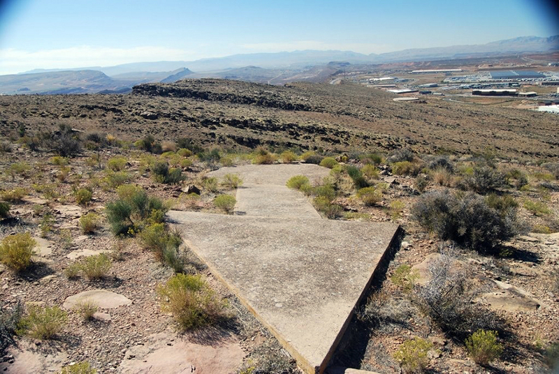
A mysterious arrowEvery so often, usually in the vast deserts of the American Southwest, a hiker or a backpacker will run across something puzzling: a large concrete arrow, as much as seventy feet in length, sitting in the middle of scrub-covered nowhere or slanted on a hillside. It points off into the distance, rarely ever point at anything one can identify. Actually, each arrow points to the next arrow, about 10 miles away, which points to the next one, and so on across the entire United States.
What are these giant arrows? Some kind of surveying mark? Landing beacons for flying saucers? Earth’s turn signals? Actually they are long forgotten but very important part of U.S. history.
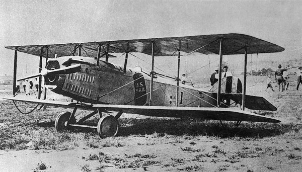
The MailmanBelieve it or not, this used to be the mailman. After the airplane became more than just a novelty for the very few, people started asking pilots who were going across country to carry letters for them. This turned into the creation of the U.S. Air Postal Service in 1923.
Air mail, of course, was not a new thing. Homing pidgeons had been used for centuries, but they always knew the way to their destination. The first human-carried air mail letter was sent by President George Washington in 1793 by hot air balloon. Balloons, however can't be guided, and go wherever the wind takes them. So, the instructions were to give it to the land owner where the balloon landed, and it would then be that person's responsibilty to get the letter to its destination.
The official first use of an airplane didn't come until 1859. On August 20, 1920, the United States opened its first coast-to-coast airmail delivery route, just 60 years after the Pony Express closed up shop. But there was a problem......
The problem was that it would be years before such things as radar or other forms of navigation would be invented. There wasn't even a radio receiver small enough to fit into a plane, much less a two-way radio. So, how did the pilots know where to go? They kept a map in their lap and looked over the side of the open-cockpitted plane at the ground, searching for some river, mountain, city in the distance, or other recognizable landmark to guide them. They "flew by the seat of their pants" or what is now called VFR (Visual Flight Rules.) The official definition of VFR is, "A set of regulations under which a pilot operates an aircraft in weather conditions generally clear enough to allow the pilot to see where the aircraft is going." So, how is that a set of rules? Well, the main rule is that if you can't tell where you're flying, stay on the ground.
But when fog or bad weather set in and the plane was already in the air, a lot of pilots couldn't ven find a place to land. Many of the early air mail pilots died in the line of duty. And, even on good days, in the vast open areas (which most of the U.S. was back then), there just weren't all that many landmarks.
So, someone came up with the idea of marking flight routes with large, very bright yellow cement arrows. By 1929, there was one set of arrows leading from San Francisco to New York, and another leading from New York to San Francisco.
But there was still a problem. The arrows could only be seen during the day. The flight across the U.S. took a minimum of 30 hours flying time, and having to stop for darkness made that 30 hours turn into 2-3 days, at least.
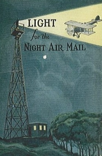
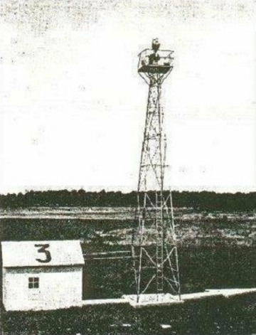
So they built beacons at every arrow and wrote a location
marker on the roof of the generator shed that powered it.
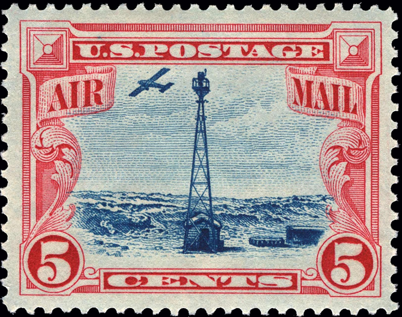
And commemorated them on the first air mail stampBut new advances in communication and navigation technology made the big arrows obsolete, and the Commerce Department decommissioned the beacons in the 1940s. The steel towers were torn down and went to the war effort, leaving only the concrete arrows.
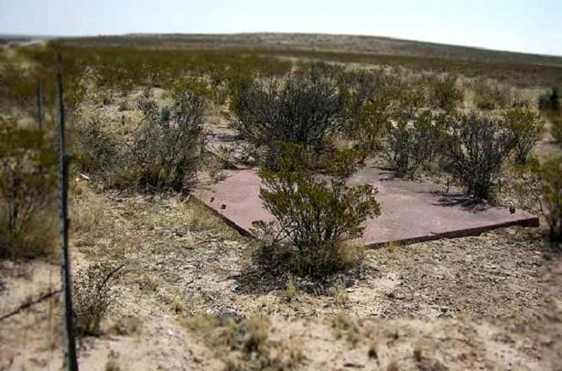
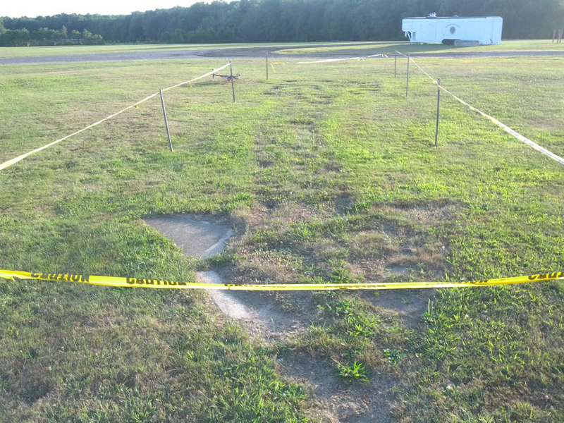
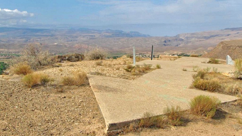
Today, all the paint has disappeared and all that is left are the large cement arrows and the fact that people have forgotten what they are or why they were there. But these arrows still span the entire United States, and can still be found if you happen onto them.
Note to viewers: I did not provide a dowsing map for this target, because the locations of the arrows were spread across the United States. However, the following map shows the area where the arrows of the SF to NY path were (and still are) located. Other routes spread to other places in the U.S. I even know of an arrow outside of Albuquerque.

If you got impressions for which this feedback is insufficient, more information,
pictures and videos can be found at the following web sites:
Wikipedia - Transcontinental airway system
CN Traveler web site
History & locations of the arrows in Utah
Sometimes-interesting.com - towers, history, maps, etc.
Arrow locations across the U.S.
Newscast video
Antique Airfields web site - excellent historical info
Wikipedia - Airmail
Many thanks to Ed Thrall for this target.