
TARGET 091118
Devils Tower
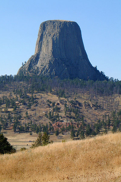
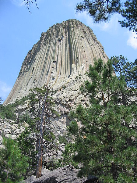
Devils Tower (In the Lakota language: Mato Tipila, which means “Bear Lodge”) is a monolithic igneous intrusion or volcanic neck located in the Black Hills near Hulett and Sundance in Crook County, northeastern Wyoming, above the Belle Fourche River. It rises dramatically 1,267 feet (386 m) above the surrounding terrain and the summit is 5,112 feet (1,558 m) above sea level.
Devils Tower was the first declared United States National Monument, established on September 24, 1906, by President Theodore Roosevelt. The Monument's boundary encloses an area of 1,347 acres (5.45 km2).
In recent years about 1% of the Monument's 400,000 annual visitors climb Devils Tower, mostly through traditional climbing techniques.
Tribes including the Arapaho, Crow, Cheyenne, Kiowa, Lakota, and Shoshone had cultural and geographical ties to the monolith before European and early American immigrants reached Wyoming. Their names for the monolith include: Aloft on a Rock (Kiowa), Bear's House (Cheyenne, Crow), Bear's Lair (Cheyenne, Crow), Bear's Lodge (Cheyenne, Lakota), Bear's Lodge Butte (Lakota), Bear's Tipi (Arapaho, Cheyenne), Tree Rock (Kiowa), and Grizzly Bear Lodge (Lakota).
The name Devil's Tower originated in 1875 during an expedition led by Col. Richard Irving Dodge when his interpreter misinterpreted the name to mean Bad God's Tower. This was later shortened to the Devil's Tower. All information signs in that area use the name "Devils Tower", following a geographic naming standard whereby the apostrophe is eliminated.
In 2005, a proposal to recognize several American Indian ties through the additional designation of the monolith as Bear Lodge National Historic Landmark met with opposition from the US Representative Barbara Cubin, arguing that a "name change will harm the tourist trade and bring economic hardship to area communities"
The landscape surrounding Devils Tower is composed mostly of sedimentary rocks.
The oldest rocks visible in Devils Tower National Monument were laid down in a shallow sea during the Triassic period, 225 to 195 million years ago. This dark red sandstone and maroon siltstone, interbedded with shale, can be seen along the Belle Fourche River. Oxidation of iron minerals causes the redness of the rocks. This rock layer is known as the Spearfish Formation.
Above the Spearfish formation is a thin band of white gypsum, called the Gypsum Springs Formation. This layer of gypsum was deposited during the Jurassic period, 195 to 136 million years ago.
Created as sea levels and climates repeatedly changed, gray-green shales (deposited in low-oxygen environments such as marshes) were interbedded with fine-grained sandstones, limestones, and sometimes thin beds of red mudstone. This composition, called the Stockade Beaver member, is part of the Sundance Formation. The Hulett Sandstone member, also part of the Sundance formation, is composed of yellow fine-grained sandstone. Resistant to weathering, it forms the nearly vertical cliffs which encircle the Tower itself.
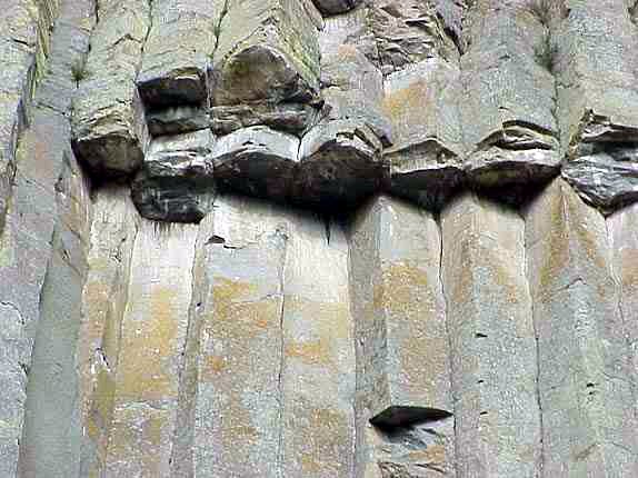
About 65 million years ago, during the Tertiary period, the Rocky Mountains and the Black Hills were uplifted. Magma rose through the crust, intruding into the existing sedimentary rock layers.
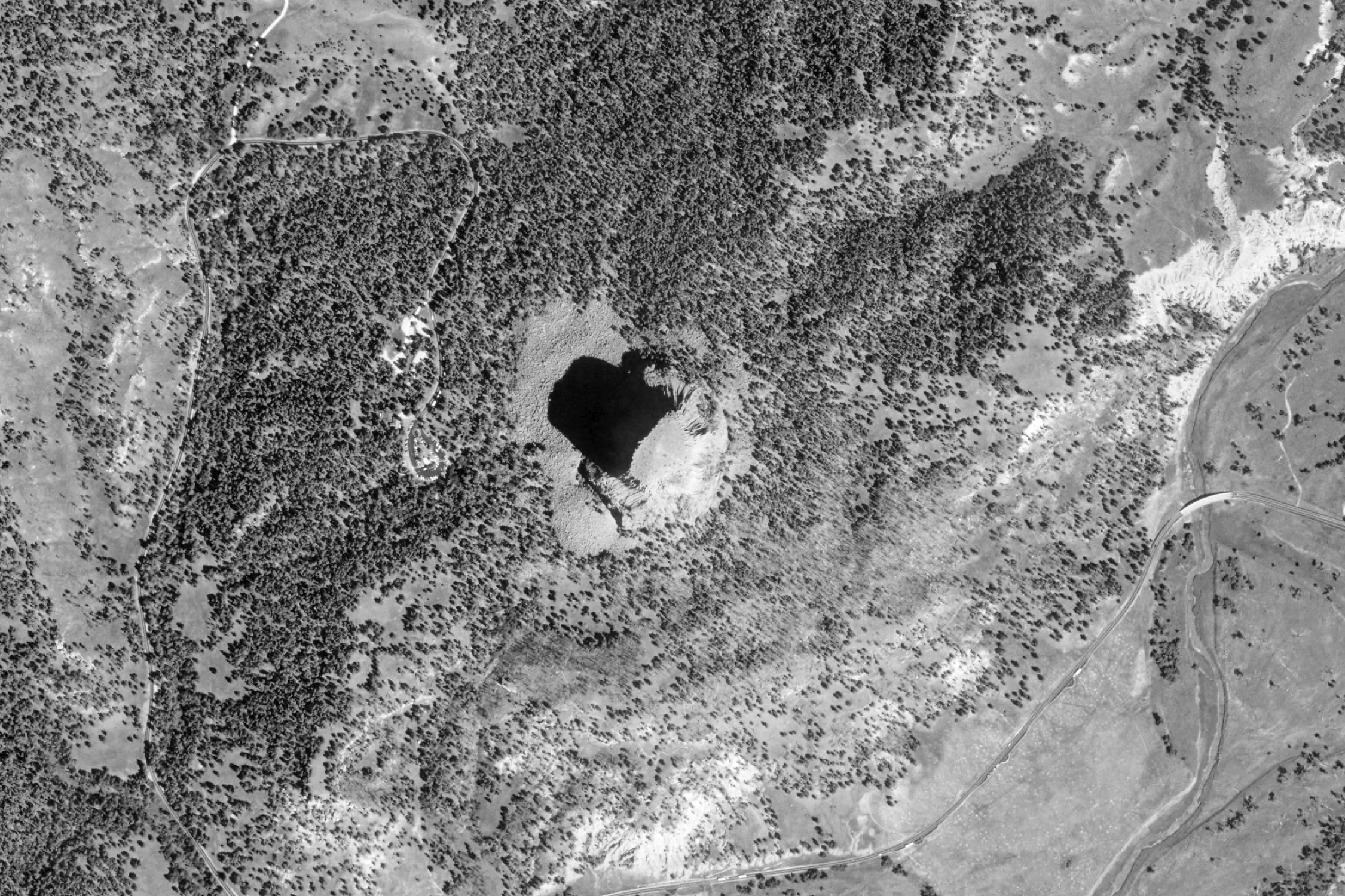
FEEDBACK MAP
If you gained information in your session which was not covered in the feedback, please take a look at these sites:
Many thanks to Ray McClure for suggesting this target, as well as doing the initial programming for the page.
Devil's Tower, Wyoming
Click here for more photos & information from Wikipedia