(From Wikipedia, the free encyclopedia.)
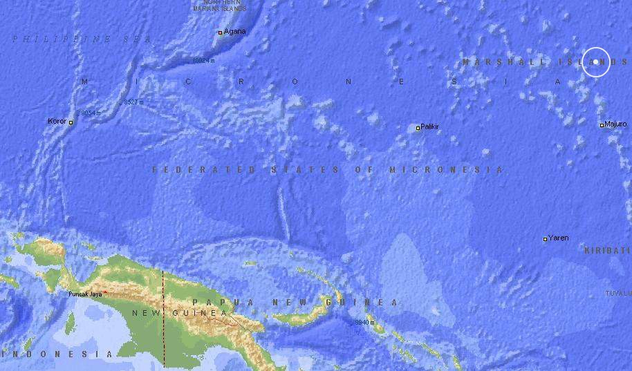
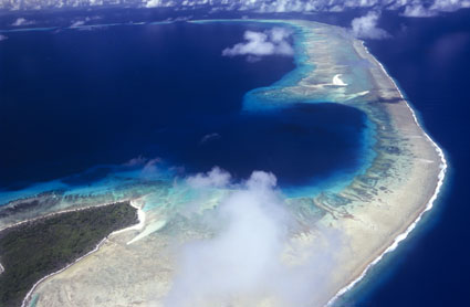
Bikini Atoll (also known as Pikinni Atoll) is an uninhabited
6.0-square-kilometer atoll in one of the Micronesian Islands
in the Pacific Ocean at 11°30?N 165°25?E. It is a member of
the Marshall Islands. It consists of 36 islands surrounding
a 594.2-square-kilometer lagoon. As part of the Pacific Proving
Grounds it was a site of more than 20 hydrogen and atomic bomb
tests between 1946 to 1958. Despite popular usage, the atoll name
is pronounced with the stress on the first syllable.
Preceding the nuclear tests, the indigenous population was relocated
to Rongerik Atoll. The tests began in July 1946.
In the late 1960s and early 1970s, some of the original islanders
returned from Kili Island but were removed because of the high
radioactivity.

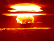
MARCH 1, 2004, marked the 50th anniversary of the BRAVO HYDROGEN
BOMB TEST, the largest weapon ever tested by the United States,
which occured on Bikini Atoll.
Above: The March 1, 1954 Bravo hydrogen bomb crater. Photo © Matt Harris
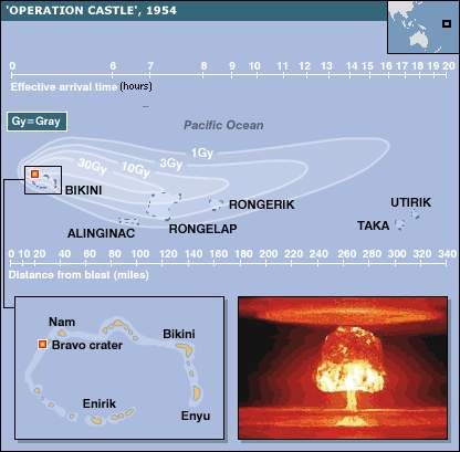
Above: a map of Bikini Atoll and its location in the Pacific,
a picture of the Bravo hydrogen blast, and a map showing the fallout
pattern.
Bikini Atoll is also the source of the name of the Bikini swimsuit.
To read more about the history, the fate of the Bikinian people,
tourism possibilities, and present day life on Bikini Atoll, click
here.
|